Folks, this one may be a near total miss, unless you ski far eastern Maine, but don't worry, it will still rain a bunch and be windy regardless... There was a lot of trepidation in Storm Update #1, but at 48 hours out we had to go with the most likely scenario and fully forecast it, but that scenario now has virtually no chance of confirming and this "storm" is effectively canceled. It is now only a light event for snow, though the wind will cause some notable issues both Friday and Saturday.
The snow from this storm won't appear until the the surface low tracks sufficiently north for the trough to phase with it. The more to the east the low tracks and of course the slower it progresses north, the longer it takes for the change to snow to happen and that pushes the snow further east. Tolerances are pretty tight so we can see big shifts to the snow with smaller shifts in the track of the low.
Let's look at the NAM3K from the last 4 runs at 8AM through the 6z run this morning. Pay attention to the low's location in each one. The last frame is from this morning's run and it shows virtually no snow for ski country! That run has the low further south and further east than the others.
Here's why I think this last run isn't a fluke. The GFS and ECMWF ensembles have shown movement to the east in the last 24 hours despite the NAM3K and other mesoscale models showing snow as far west as the edge of VT yesterday evening. The last run of the NAM3K is now a pretty close match for the GFS in fact and that right there is the icing on my cake as far as this storm goes.
The GFS and ECMWF head-faked this earlier, at least in the ensembles, but they started to correct before the NAM3K, NAM12K, FV3, and HRRR mesoscale models did. All of those mesoscale models are NOAA models and they get fed data from the same sources and have some similarities that can cause similar behaviors at times in how storms are modeled. So it makes sense that we could see all of the mesoscale models shift west while the medium-range models shifted east for a period of time as they aren't all perfectly independent of each other.
So what does the snow look like? Well, it presently doesn't look huntable I'm afraid.
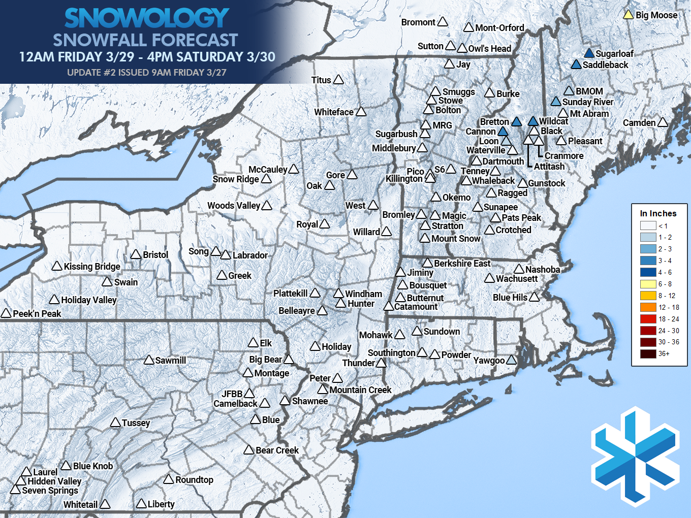
It does however look like the only open ski area on Friday that will be rainy after open will be Pleasant Mountain (if they open Friday). Many in NH and ME though will be quite soggy, and there will be some snow on parts of the Whites and Longfellows after open instead of rain. There will also be wind issues Friday and Saturday, and those will be covered below the paywall.
I will update again this evening in a subscriber alert if there is a notable enough shift to affect some ski areas, but I do not expect notable changes with the wind modeling from here. A small shift could bring enough snow to matter for a few mountains, but chances of a deep powder day are generally very slim. We are pulling however for Big Moose to get enough snow to reopen and they are certainly far enough east for there to be a chance, and upper terrain at Sugarloaf and Saddleback are next on the list for the possibility of a meaningful upgrade but with the wind in that area it may be of little consequence.